

The new version of MapInfo Pro v2021 released with innovative features
MapInfo Pro v2021
With MapInfo Pro, you can manage, analyse, and visualise data in one place. The combination of maps, demographics, and result-driven modelling tools enable the identification of patterns otherwise invisible and influence decisions.
With every version of MapInfo Pro, diverse industries from Telecom to Insurance, Finance, Retail, and more have been able to explore spatial data within a dataset, symbolise features, and create maps.
MapInfo Pro v2021- New version, New possibilities
MapInfo Pro v 2021
Time Series Capability
Depending on the structure of your table, you can select different time configurations in the "Layer Time Properties". The time frame extent of the data you want to analyze or visualise can be determined once you have selected the appropriate time configuration. Furthermore, you can select how to aggregate the data based on the period length within the time frame. A whole set of new tools are available once the properties are determined, such as sequence visualisation.
Powerful, Multi-Resolution Raster (MRR)
The Multi-Resolution Raster (MRR) format offers users outstanding processing power for image analysis. MapInfo Pro support for Multi-Resolution Virtual Raster (MVR) data provides users with more flexibility when processing this special type of raster that can be used either as input or output depending on the tool.
Select Data by Attribute
The new "Select by Attribute" tool provides a new method for browsing, visualizing, or exporting data. New types of selection tools are based on operators that you specify for one or more fields in your data table. With the tool, you can define conditions easily without having to think about syntax or query structure as with a traditional SQL query.
Accessibility & Flexibility
A new release of MapInfo Pro gives users greater accessibility and versatility. Users can access and use new file formats aligned with GDAL/OGR formats. The supported file formats are GeoJSON, KML, GML, and vector tiles.
Data Projection & Integration
With this release, MapInfo Pro automatically reprojects tiled web services and WMTS. With this feature, you can manage the alignment of the tiled data on the server in your coordinate system. Less data management means more time for viewing, analysing, and calculating.
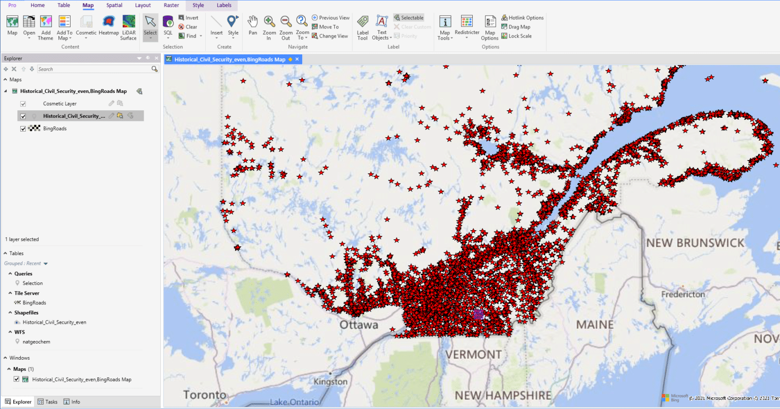
Web Feature Service
MapInfo Pro's 2021 version has service layers that contain millions of points that describe historical events or distributions of natural resources. Additionally, WFS 2.0 has introduced new paging capabilities, allowing users to control how much data is loaded into memory during a transfer, as well as how many features are displayed in the map browser. The WFS now allows you to customise what you want to visualise and to quickly update your project with additional data.